 |
|
|
|
|
|
|
 |
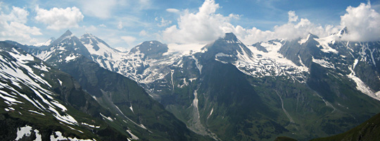 |
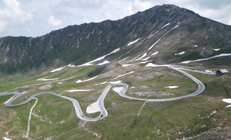
| Left: switchback section just below Fuscher Törl. Right: view from Fuscher Törl. |
| For
many years it is our intention to cycle, with a racing bike, all passes
in (western) Europe that exceed the (arbitrary) elevation of 2500
meters. The Großglockner Hochalpenstraße is one of them and
was still on our to do list. Both the north and south slope offer
pretty demanding ascents, but it seems that the approach from Fusch an
der Großglocknerstraße is the most challenging. You have to
climb 1850 hm in 27 km, including a descent of 160 hm between Fuscher
Törl and Hochtor, the highest point (except for the
Edelweiß-Spitze, a dead end road specially constructed to please
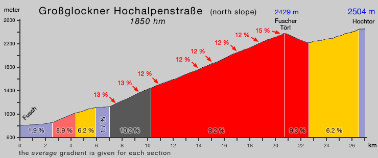
motor bikers). Roughly half of the ascent has an average grade
of over 9%, with several 12-15% sections. It is a tough climb because of its length and grade, but perfectly doable. For an alpine pass road, the Großglocknerstraße is exceptional wide, which means that even large touring cars do not obstruct the switchbacks. It is a toll road, but free to cyclists, they have to pass a zigzag shaped road block that is too narrow for bikes. |
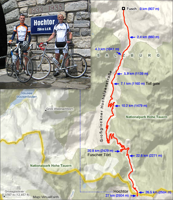
| Below: map and gradient profile of the Großglockner Hochalpenstraße. |
 |
 |

Tracks, distances, profiles and gradients are based on Garmin Edge 705 data
| start page | Jaufenpass Timmelsjoch |
Sella Gardena Campolongo Pordoi |
Fedaia | Santa Lucia Giau Falzarego |
Gardeccia Ciampie |
Kaprunertal Stubachtal |
Großglockner |