 |
|
 |
|
|
|
|
 |
 |
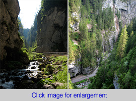 |
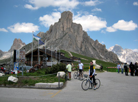
| Left: view from the ascent to Colle Santa Lucia. Middle: Passo di Giau with Monte Averau (2648 m). Right: Sottoguda gorge (click for enlargement and additional information, which will appear in a new window). |
| Besides
the Sella, Gardena, Campolongo and Pordoi pass (see Sella Ronda page)
the Passo di Giau and Passo di Falzarego are part of the Maratona dles
Dolomiti (Dolomites marathon for cyclists). The seventh Marathon pass,
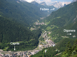
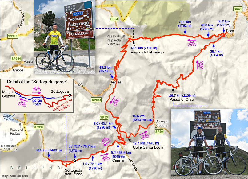
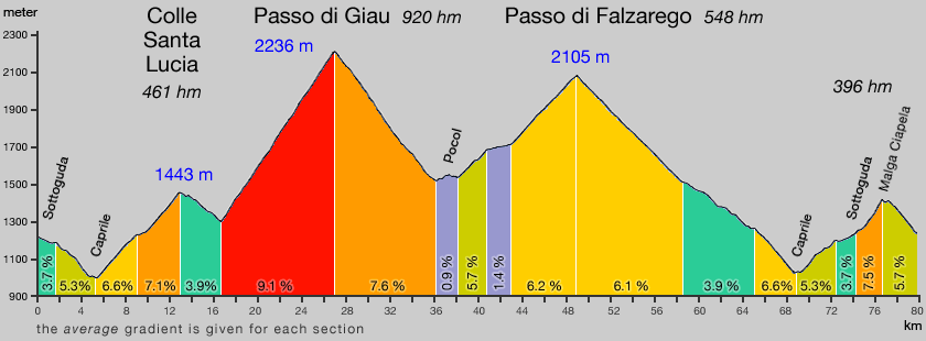
Passo di Valparola, is only 1.5 km and 86 hm north of the Falzarego pass. The Giau is the second most challenging pass in this part of the Dolomites. Only the ascent of the Fedáia from Caprile is more demanding. The south slope of the Giau is the 'classic' approach. The 10 km climb from 1343 m (km 16.6) to the pass at 2236 is steep (9.1% average), but remarkably regular; it doesn't exceed 13% (18% for Fedáia). Descending to Pocol (direction of Cortina d'Ampezzo) is fine; good quality asphalt and nice switchbacks and bends. As the map shows I have started our Santa Lucia-Giau-Falzarego tour in Sottoguda, which is about halfway the descent of the Fedáia. A start and finish in Alba di Canazei adds 22 km and 1400 hm to the tour and brings the total effort to 102 km and 3480 hm, instead of 80 km and 2325 hm. Ward has started in Sottoguda, but stopped not before Hotel Aurora in Alba di Canazei. In Sottoguda, when cycling in the direction of the Passo di Fedaia, you can either take the main road, or take the old, narrow road through the gorge (Serai di Sottoguda). Highly recommended !; see separate page for details. |
| Below: map and gradient profile of the Colle Santa Lucia, Passo di Giau and Passo di Falzarego. |
 |
 |

Tracks, distances, profiles and gradients are based on Garmin Edge 705 data
| start page | Jaufenpass Timmelsjoch |
Sella Gardena Campolongo Pordoi |
Fedaia | Santa Lucia Giau Falzarego |
Gardeccia Ciampie |
Kaprunertal Stubachtal |
Großglockner |