 |
|
 |
|
|
|
|
 |
 |
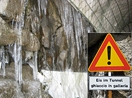 |
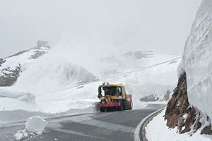
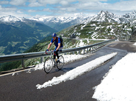
| Snow
and ice at the beginning of our tour. Left: snowplough in action at the Austrian side of the
Timmelsjoch. Middle: last snow at the Jaufenpass. Right: warning for ice in a tunnel near the Timmelsjoch summit (Italian side). |
| We
had the intention to start our tour in Sölden, at the (Austrian)
lower end of the Timmelsjoch ascent. However, the weather was bad at
the north side of the Alps; rain in the valleys, snow above 2000
meters. Therefore, we crossed the border by car and drove to Sankt
Leonhard in Passeier (San Leonardo in Passiria, but nearly every body
speaks German in that part of Italy), where it was sunny and 20+
degrees. Moreover, St Leonhard is a more pleasant village to stay than
Sölden, which was desolated. It seems to be mainly a wintersport
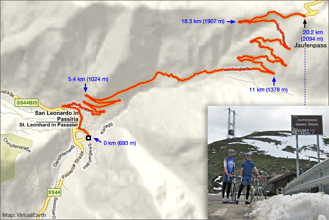
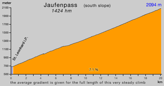
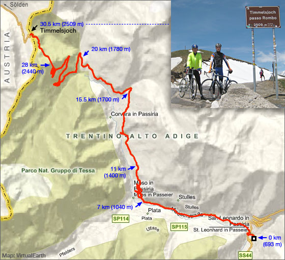
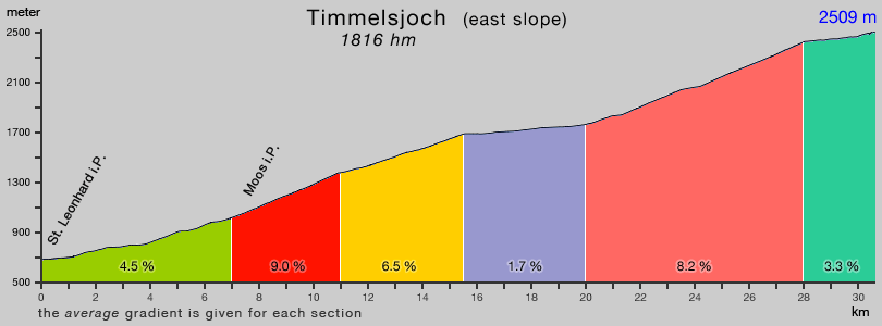
resort. St Leonhard was the starting point for two nice climbs. First the easy going and extremely steady climbing Jaufenpass (Passo di Monte Giovo). Timmelsjoch (Passo del Rombo) was on the menu for next day. A longer and quite irregular climb. Certainly more demanding than the Austrian ascent, but very scenic. Starting in Italy rather than Austria was in all respect a good choice. |
| Below: map and gradient profile of the Jaufenpass and Timmelsjoch. |
 |
 |
 |
 |

Tracks, distances, profiles and gradients are based on Garmin Edge 705 data.
| start page | Jaufenpass Timmelsjoch |
Sella Gardena Campolongo Pordoi |
Fedaia | Santa Lucia Giau Falzarego |
Gardeccia Ciampie |
Kaprunertal Stubachtal |
Großglockner |