|
Introduction.
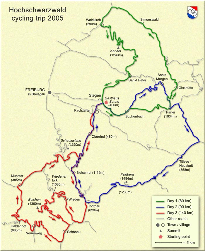
The Hochschwarzwald region
(map), east south-east and south
of Freiburg is the most mountainous part of the Black Forest.
It is comparable to its "mirror region", the French
Vosges (the two are separated by the river Rhine). Towns and villages
have a typical elevation between 200 and 600 meters, whereas the
highest elevations are between 1200 and 1500 meters.
The website of the Dreisamtal region (the river Dreisam passes
Freiburg) offers a list of "Radfreundliche Betriebe"
(hotels and pensions that welcome bikers). From that list we have
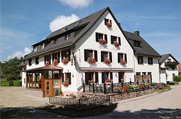
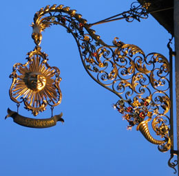
chosen Gasthaus Sonne in Stegen-Oberbirken (see photos
below). A recommendable hotel: quiet location, friendly people,
excellent food and moderately priced.
Of the three daytrips that we
have made (see map below) the following sections are particularly
worthwhile:
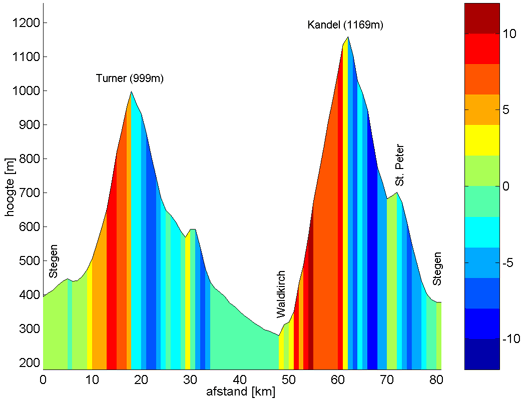
a. Waldkirch -Kandel (1243m) - Sankt Peter Stegen; click
here for gradient profile;
b. Buchenbach -Turner (1034m) - Glashütte - Gutachtal (lovely
narrow and windy local road) - Simonswald; click
here for gradient profile;
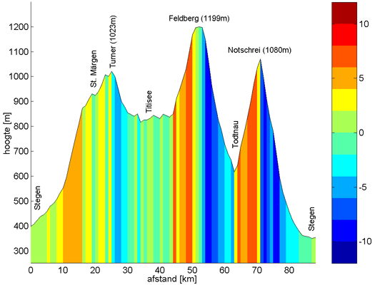
c. Buchenbach - Sankt Märgen - Turner; click
here for gradient profile;
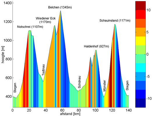
d. Oberried - Notschrei * (1119m) - Todtnau (* Notschei means
Cry of Distress !); click
here for gradient profile of north slope / south
slope;
e. Todtnau - Wieden - Wiedener Eck (1035m) - Belchen (1360m, see
note below) - Schönau - Neuenweg - Haldenhof (885m) - Münster;
click here for gradient profile of Belchen
/ Haldenhof;
f. climbing to Schauinsland (1250m) or Notschrei (1119m) from
the Münster valley (an attractive, but partly pretty steep
and narrow local road); click here
for gradient profile;
g. climbing to Schauinsland from Freiburg (but no experience since
the road was temporarily closed due to road works);
Note: the paved road seems to
end at the bottom station of the Belchen cableway; however, after
a 200 m unpaved section at right of parking area directly besides
the station the former still paved road continues
to the top station of the cableway !
The descent from Turner towards
Titisee Neustadt (Jostal) is fine, but not spectacular.
The road from Titisee, via Feldberg (1230m) to Todtnau was disappointing
(too many tourists along the lake and too many cars on the Bundesstrasse
B317).
Click
here for gradient profiles of daytrips 1, 2 and 3.
|

